California’s iconic coast is home to many of California’s precious natural, cultural, and historic resources. The public policy of protecting, expanding, enhancing, and promoting public access to the state’s coast, tidelands, and waterways is embodied in California’s Constitution, numerous laws, and the common law Public Trust Doctrine. California is a world leader in protecting its coast and advancing the right of all people to access and enjoy our beaches and ocean.
Hollister Ranch is a 14,500-acre gated subdivision in Santa Barbara County that includes 8.5 miles of publicly owned shoreline, though no public access. The 60-mile section of the Santa Barbara coast from Hollister Ranch to Point Sal is one of the least accessible shorelines in California, with less than 5 miles available for public use.
Recorded Workshop
Public Workshop on Draft Conceptual Components recorded June 16, 2021.
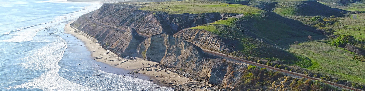
The Beaches

Topographic map of the beaches of Hollister Ranch on the Santa Barbara Channel.
In 1981, the California Coastal Commission adopted an initial Hollister Ranch Public Access Program, which it updated a year later. The final program called for a phased and monitored approach to opening and managing access to the Ranch. Despite numerous legislative, legal, and administrative efforts over the past few decades, there is still no public access to the 8.5 miles of coast at Hollister Ranch.
In 2019, State Parks, the California Coastal Commission, the Coastal Conservancy, and the State Lands Commission entered into an interagency collaboration agreement to achieve public access to and along the coast at Hollister Ranch. The agencies have worked since that time, in conjunction with the public, to update the Hollister Ranch public access program to finally provide public access to this stretch of coastline.
For additional information, please see the Coastal Commission’s Hollister Ranch website or the State Coastal Conservancy’s Hollister Ranch website.
If you would like to be included on the Hollister Ranch Coastal Access Program, please email hrcap@ascent.inc
Frequently Asked Questions
Answers to frequently asked questions about Hollister Ranch can be found below in both English and Spanish.
Informational Update
In April 2019, Commission staff provided an informational update about public access and Hollister Ranch. Below are the slides that accompanied the staff presentation. The presentation highlights the fabulous survey and drone work our staff performed in late 2018 and early 2019. The presentations include information about the mean high tide line, drone imagery, and some of the products generated with Drone2Map photogrammetry software. Videos of drone flights and generated 3D Models are available through the Commission’s YouTube account.
April 5, 2019, Staff Report 73
Planning Update
Previous Staff Reports
| Meeting Date | Item | Description |
|---|---|---|
| 10/25/2022 | 62 | Consider authorizing the Executive Officer, or her designee, to execute a Memorandum of Agreement among the California State Lands Commission, the California Coastal Commission, the California State Coastal Conservancy, and the California Department of Parks and Recreation Regarding the Interagency Coordinated Review and Preparation of Environmental Review Documents for the Hollister Ranch Coastal Access Program |
| 6/23/2022 | 47 | Solicit by appropriate procurement methods for consultant services, negotiate fair and reasonable prices, and award and execute agreements for the preparation of environmental documentation and real estate appraisal(s) for the Hollister Ranch Coastal Access Program in southwestern Santa Barbara County, and request delegation of authority to the Executive Officer or her designee to enter into an interagency agreement with the State Coastal Conservancy (SCC) to allow transfer of funds from SCC to the Commission in furtherance of such agreements. |
| 6/28/2019 | 94 | Considering supporting AB 1680 (Limon) in the 2019-20 legislative session that would require the California Coastal Commission, in collaboration with the California State Coastal Conservancy, the Department of Parks and Recreation, and the State Lands Commission to develop a new Coastal Access Plan for Hollister Ranch in the County of Santa Barbara. |
| 4/5/2019 | 73 | Informational update on efforts to achieve meaningful Public Access to the coast at Hollister Ranch, Santa Barbara County |
| 1/23/1984 | 10 | Authorize approval of a Mean High Tide Line survey |