Start your Application or Inquiry Application Process Rent and Benchmark Information Tomales Bay Mooring Program Dredging on Granted Lands Geophysical Survey Permit Program Pay Online If your property has been affected by the Palisades Fire and you need State Lands... Read MoreRead more about Palisades Fire Permit Inquiries
The Commission is required to recalculate minimum annual rents every five years for the various surface use lease and permit categories it authorizes. The minimum annual rent applies when the calculated rent is lower than the minimum rent. These rents do not apply to... Read MoreRead more about Minimum Rents
On this pageCategory 1 MethodologyCategory 2 MethodologyMap of Benchmark Areas Benchmarks are used to establish uniform rental rates in specific geographic areas with large concentrations of similar facilities, mostly private recreational improvements. These... Read MoreRead more about Benchmark Methodology Overview
Geophysical Survey Permit Program Last updated: 07/31/2026 Permit NumberPermitteeContact InformationPermit Expiration 9215EGS Americas, Inc.Eric Roach eroach@egsamericas.com 772.341.92862026-08-16 9755SubCom, LLCChristopher Carobene ccarobene@subcom.com... Read MoreRead more about Current Permittees
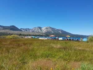 Read more about Updated Lake Tahoe Rent Methodology Study – Public Comments & Responses
The Commission is updating its 2012 Category 1 Lake Tahoe Berths and Buoys benchmark rental rates and establishing a Category 2 Lake Tahoe benchmark rental rate for non-water-dependent uses. These rates are used to determine rent or other compensation as part of a... Read MoreRead more about Updated Lake Tahoe Rent Methodology Study – Public Comments & Responses